Know what you're getting
Before we take flight
Transparent pricing for all drone services
We believe that sharing all our prices and sticking to them helps to grow a strong relationship.
These prices are kept up-to-date regularly and we will stick to them.
Photo & Video Package
$190
Photo Package
-
your pick of 5 edited hi-res pics
-
additional pictures $7 each
$700
Multi season photos
-
4 'photo package'
-
your choice of what season and when
-
great for showing project progress or changes in growing seasons
4 'photo package'
your choice of what season and when
great for showing project progress or changes in growing seasons
$375
Photo & Video
-
5 edited hi-res pics.
-
30 second edited video.
-
your pick of aerial shots and music
$1125
Multi season photo & video
-
4 'photo & video packages'
-
your choice which of season and when
-
great for showing growth or progress over time
4 'photo & video packages'
your choice which of season and when
great for showing growth or progress over time
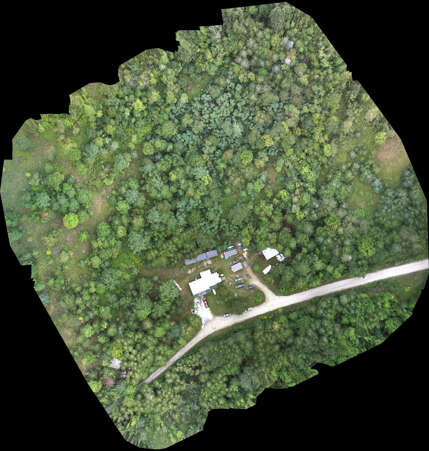
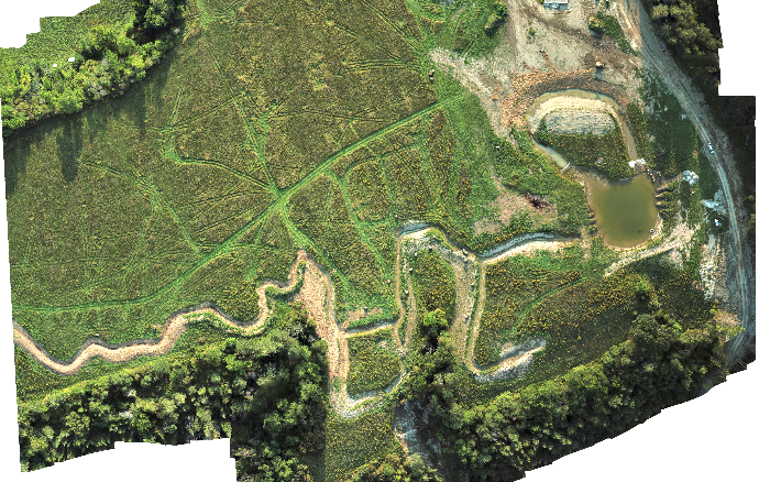
2D Mapping Packages
$475
Intro Mapping Package
-
25 acres or less
-
2D RGB map
-
Google KML, Geo TIFF & PDF of map.
-
GCP (ground control points) available at extra cost
$856
Extended Mapping Package
-
160 acres or less
-
2D RGB map
-
Google KML, Geo TIFF, & PDF of map
-
GCP (ground control points) available at extra cost
160 acres or less
2D RGB map
Google KML, Geo TIFF, & PDF of map
GCP (ground control points) available at extra cost
$2000
Project Timeline Package
-
5 'Intro Mapping Packages'
-
chose your own frequency, monthly, annually or custom
$3400
Project Timeline Package
-
5 'Extended Mapping Packages'
-
Choose your own frequency, monthly annually or custom
5 'Extended Mapping Packages'
Choose your own frequency, monthly annually or custom
Advanced Mapping Packages
$675
Intro 3D Mapping Package
-
25 acres or less
-
3D RGB map
-
3D Google Earth KMZ, Geo TIFF & PDF of map.
-
3D model OBJ file
-
Colorized DEM
-
GCP (ground control points) available at extra cost
$1050
Extended 3D Mapping Package
-
160 acres or less
-
3D RGB map
-
3D Google Earth KMZ, Geo TIFF, & PDF of map
-
3D Model OBJ file
-
Colorized DEM
-
GCP (ground control points) available at extra cost
160 acres or less
3D RGB map
3D Google Earth KMZ, Geo TIFF, & PDF of map
3D Model OBJ file
Colorized DEM
GCP (ground control points) available at extra cost
$2000
Project Timeline Package
-
5 'Intro Mapping Packages'
-
chose your own frequency, monthly, annually or custom
$3400
Project Timeline Package
-
5 'Extended Mapping Packages'
-
Choose your own frequency, monthly annually or custom
5 'Extended Mapping Packages'
Choose your own frequency, monthly annually or custom
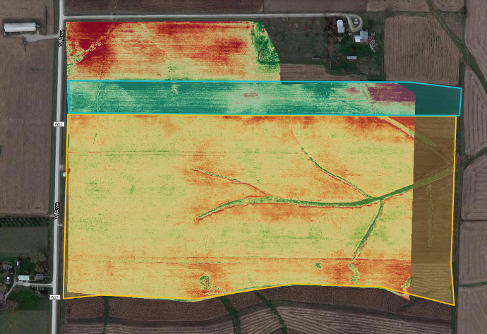
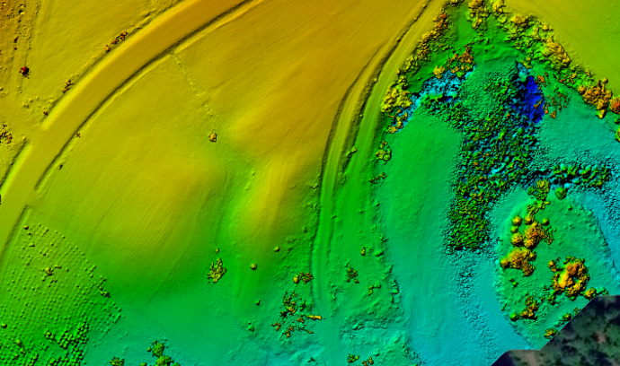
Get the precision you deserve
Drone Mapping gives a level of detail and accuracy not comparable to that of freely available online with google earth or other topographical maps.
Our drone maps can be made to fit your needs giving hi-resolution, Digital elevation models, high detail or a general over view.
Learn more
Additional Services
-
Ground Control points $190 /hour
Give your map additional high level accuracy
-
Additional Post processing $130 /hour
Volume calculation, Area, measurements etc.
-
Photo or Video Editing $95 /hour
Adobe Photoshop, Premiere, After Effects
-
Additional employee $70 /hour
Ground crew personnel, additional pilot, spotter, or tech assistant
-
Travel Charges $0.61 /Km
Beyond 40km from Chelsea, Quebec